 Strengthening their organizations has enabled the Cofan to preserve their cultural identity and ancient knowledge.
Thomas J. Müller
 Strengthening their organizations has enabled the Cofan to preserve their cultural identity and ancient knowledge.
Thomas J. Müller
“Soy caminante de la selva…” (I am a forest traveler.) Willian Lucitante plays many roles in his community: charismatic leader, one of the active guardians of almost 1 million acres of Amazonian rainforest in northern Ecuador, and perhaps surprisingly, a technical expert in the use of Geographic Information Systems (GIS)—a way to capture and analyze data visually.
Lucitante is working with his fellow members of the A’i indigenous community (commonly known as the Cofan) to preserve their culture. Protecting their territory is integral to this, and has ramifications that reach well beyond the rainforest.
The 1,200 Cofan people depend on the forest and rivers in and around their territories for many of the most basic aspects of sustenance—food, water, transportation, medicinal plants and materials for producing everything from hammocks to cooking pots. While the Cofan are not an isolated group in the Amazon, and also use a variety of modern products and services, they have a history of protecting their territory because it is critical to their food security.
The health of the Cofan forests, and the life they support, faces the same threats that appear across the Amazon. These threats are increasing in severity: accelerating deforestation from road construction; overhunting and fishing; illegal poaching and trafficking of wildlife; pollution from oil extraction and mining; and impacts from climate change, including increasingly severe droughts, floods and shifting rainfall patterns.
With USAID support spanning over 10 years, the Cofan are combining their traditional knowledge of the forest with both active leadership and representation by the Federation of the Cofan Nation (FEINCE), as well as with the tools of modern technology.
Thanks to USAID technical support and funding, the Cofan have built FEINCE into a robust, autonomous and democratic organization that is a model for self-representation and management for indigenous groups in the Amazon.
USAID, The Nature Conservancy and other partners helped FEINCE get its own office with a transparent accounting system, computers, vehicles and other equipment for Cofan community park guards. The support has also included bolstering the community’s talents and impact by providing Spanish-language training to Cofan women, sponsoring men and women to learn together with their peers via exchange visits to indigenous projects in Colombia, Bolivia and Peru, and helping the Cofan develop a long-range strategy for social development and conservation, or “life plans.”
With these enhanced skills and tools, together with their invaluable traditional knowledge, the Cofan are exercising their voice in decisions about using natural resources, and are investing in youth who will continue the fight to preserve the Cofan culture and territory as scientists, lawyers, doctors and political leaders.
“The Cofan are tigers in the forest, but they need different skills to participate effectively in an office setting,” says Marcelo Guevara, director of The Nature Conservancy’s Amazon program, a partner of USAID’s Initiative for Conservation in the Andean Amazon (ICAA). “The lack of tools and capacity to participate is changing. They are no longer mute witnesses to the economic development going on in their region.”
Guevara says that the Cofan now come to meetings with government officials with maps to show specifically where they are having trouble with illegal mining or encroachment into their territory. The ability to point to a map and tell the local mayor exactly where poachers or land grabbers are entering indigenous lands “has given them a political weight,” says Guevara.
These threats and opportunities are similar for the majority of the 385 indigenous groups in the Amazon region. For this reason, USAID’s ICAA works regionally with indigenous populations to conserve the Amazon biome in Colombia, Ecuador and Peru. Several studies show that deforestation and illegal trafficking of species are significantly lower in indigenous territories, even when compared with natural protected areas, such as national parks and reserves.
Monica Suquilanda, ICAA’s project manager in Ecuador, notes, “With legally recognized indigenous territories constituting over a quarter of the Amazon biome, working with indigenous peoples towards the conservation of this region is key.”
ICAA’s regional approach includes support for patrolling and training that will guide conservation of the region’s vast indigenous territories. USAID helps indigenous leaders put forth voices and votes in a variety of international forums through ICAA’s collaboration with the Coordinating Body of Indigenous Organizations of the Amazon River Basin. The body brings together the national indigenous federations of all eight Amazon countries and the territory of French Guyana.
USAID’s partners in the ICAA program work with 25 ethnic groups, strengthening their skills and helping them engage with their respective government agencies, universities and NGOs, with the shared goal of conserving biodiversity in the Amazon forests and improving the quality of life of the region’s citizens.
Maps for Conservation
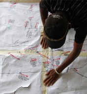
In 2011, The Nature Conservancy began working closely with the Cofan to develop the first multi-year land use and vegetative cover map ever completed in the Andean Amazon. The map presents a clear picture of how the Sucumbíos region, including the Cofan territory, has changed between 1990 and 2012, and projects future changes through 2030. Cofan community park guards verified the conservancy’s analysis of satellite images, combining the rangers’ on-the-ground expertise with the latest in spatial analysis and mapping.
Says Guevara: “There were many sites in the Cofan territory that were inaccessible to us. After I explained the methodology and purpose of the map, each guard was able to report on his specific area of territorial expertise, correcting mistakes such as how different areas were affected by seasonal water flows, or whether a certain area that looked like forest was actually a plantation of palm trees.”
Lucitante was one of the first trainees involved in the GIS collaboration, and demonstrated a real skill for it. Guevara noted that even in his earlier job as a GIS professor at one of Ecuador’s premier private universities, he had rarely encountered students who learned so quickly with such strong interest in the subject. Lucitante showed such promise and commitment in the GIS project that he was selected for a training course in the United States, where he learned advanced skills in spatial analysis and mapping—skills he is now using in his latest role as a trainer and mentor for his fellow Cofan mappers and park guards.
As a result of their practical contribution to the multi-year map and the related training courses, the Cofan now independently use global positioning systems (GPS) and GIS. They created a computer lab in the FEINCE headquarters where the Cofan continually generate new maps based on their field data from rangers and other data sets.
With these maps and the spatial analysis in their toolkit, the Cofan are empowered when they meet with public officials and can provide information for natural resource decision making. They can also denounce illegal hunting and land invasions via the judicial system based on their own evidence and maps.
The bright green areas on a series of maps depict the Cofan forests, and show increasing urbanization, agriculture and ranching moving into the rainforest, providing evidence that the Cofan are conserving their forests in the face of the threats. Among the veins of fuschia and gray spiraling out from cities and roads that indicate conversion of land from forest to pasture and fields, the notable blocks of solid green are the Cofan territories. These blocks of green remain stable while the surrounding land degrades over time.
Guevara sees this as evidence “that at the provincial level, the Cofan are the group that best protects the forest.”
The community’s success in conserving territory is also accepted at the national level. The Cofan are one of the few indigenous groups to have an official agreement with Ecuador’s Ministry of Environment that allows them to serve as park rangers, patrolling and enforcing regulations for forest conservation in territory outside of the national park system. With their new technological capacity, the Cofan can better identify priority areas that are threatened by roads or farm expansion and then address those critical drivers of deforestation, going to the source of the threat to their territory and finding a lasting solution.
Getting Youth Involved
Lucitante admits to being concerned about Cofan youth leaving the forest and viewing their home as an area to exploit for natural resources. However, new technologies like GPS, coupled with traditional knowledge, are giving the Cofan youth a unique employment advantage. In 2011, USAID supported an Ecuadorian university research project that studied the remaining populations and habitat of two endangered species of river otters. The research team collaborated closely with members of the Cofan community and trained them as “parabiologists” (similar to a paralegal), which included training in the use of GPS and other data collection and analysis techniques.
Veronica Cano, one of the lead researchers noted that without the team of Cofan collaborators, the project wouldn’t have been able to include territory that was so difficult to access. Cofans enabled the researchers to confirm that a species of river otter, considered extinct until 2003, had rebounded significantly and was maintaining healthy communities in six of the seven watersheds they monitored.
“We hope to continue this monitoring next year, with the help of this team of young parabiologists,” says Cano.
As the vice-president of FEINCE, Lucitante leads his community in making important decisions.
“When I compare our traditional knowledge to Western knowledge and modern technology, I realize the importance of my ability to use and understand tools like GIS,” he says. “The Cofan territory is large, and we don’t have concrete information about the landscape, the location of hunting and fishing grounds, or the watershed. The ability to present data about our territory to the community, as well as the provincial government, is extremely important. We have been able to speak directly with the government about what we would like to see occur in our territory.”
During the last decade, Ecuador has experienced one of the highest rates of deforestation in South America. Recent NASA satellite data showed a 300 percent increase in deforestation in early 2013 compared to the same period in 2012. Two-thirds of this deforestation occurred in the Amazon rainforests. These forests play a critical role both in the lives of local communities like the Cofan, as well as on a global level.
“The Cofan community shares a vision of the necessity of conserving our territory because these are the resources we need for our culture to continue without disruption,” says Lucitante. “We are trying to live without contaminating these resources, and this doesn’t only benefit us. The forests we are conserving absorb carbon pollution from other places. The forest provides benefits not only for the communities actually conserving it, but also for the region, the country and the planet.”
Cash for Conservation
In addition to playing a proactive role in environmental governance, the Cofan are using GIS to access Socio Bosque (Forest Partnership), a cash-for-conservation program managed by the Ecuadorian Government. Socio Bosque requires participants to demonstrate clear land title and to have a management plan that includes digital maps of the property—requirements that are prohibitively challenging for many indigenous communities in Ecuador’s Amazon. With assistance from The Nature Conservancy, the Cofan have successfully registered three areas with Socio Bosque that cover almost 200,000 acres, or 20 percent of the Cofan territory in Ecuador, and they plan to register three more. This 20-year voluntary conservation agreement could provide over $130,000 per year to the Cofan community.





Comment
Make a general inquiry or suggest an improvement.